-
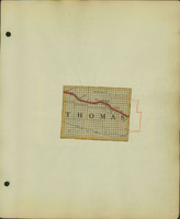
 Thomas County, July 3-11, July 27-30, 1911
 Narratives
-
 Thomas County, July 3-11, July 27-30, 1911
 Narratives
-
 Thomas County, July 3-11, July 27-30, 1911
 Narratives
-
 Thomas County, July 3-11, July 27-30, 1911
 Narratives
-
 Thomas County, July 3-11, July 27-30, 1911
 Narratives
-
 Thomas County, July 3-11, July 27-30, 1911
 Narratives
-
 Thomas County, July 3-11, July 27-30, 1911
 Narratives
-
 Thomas County, July 3-11, July 27-30, 1911
 Narratives
-
 Thomas County, July 3-11, July 27-30, 1911
 Narratives
-
 Thomas County, July 3-11, July 27-30, 1911
 Narratives
-
 Thomas County, July 3-11, July 27-30, 1911
 Narratives
-
 Thomas County, July 3-11, July 27-30, 1911
 Narratives
-
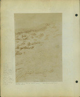
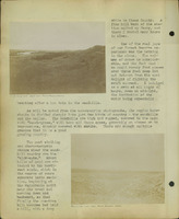
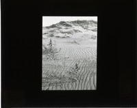 Blowout ripples
 Original caption: Sand ripples in blowout, Cherry Co, 1911, July F.H.S. Cherry County. Frank H. Shoemaker (121111-00021)
-
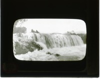
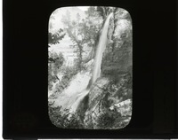 Waterfall
 Original caption: 4-26-7-00 ? Falls Nebr., East of Valentine. 1900(?) (121111-00057)
-
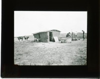 Sod house
 Original caption: Cherry Co. Soddy Now nearly obsolete. F.H.S. July 1911. Three men outside of small soddy, with some cattle and water basin. Cherry County. Frank H. Shoemaker (121111-00059)
-
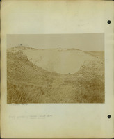
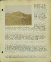
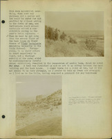
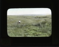
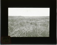 Grass landscape
 View of grassland prairie, possibly near Hackberry Lake. Cherry County. (121111-00070)
-
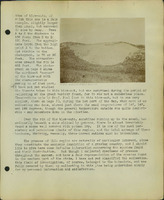
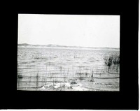 Clear Lake
 Original caption: Clear Lake, Cherry Co. July 1911 F.H.S. Cherry County. Frank H. Shoemaker (121111-00082)
-
 Mill, Wauneta
 Original caption: Nebraska High Plains, Frenchman Valley at Wauneta. Chase County.(121111-00109)
-
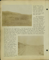
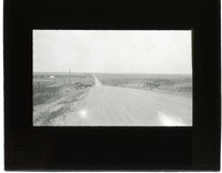 Plains road, Imperial
 Original caption: Nebraska High Plains, 4-22-30, Perkins Plain, 4 mi. east of Imperial. 1930. Chase County. (121111-00110)
-
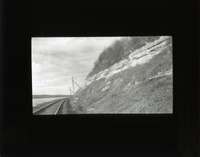
 Loess canyon, Wauneta
 Original caption: Loess canyon topography, 3 mi., N. of Wauneta, Nebr. 8/29/16 5x NAB. 1916. Chase County. (121111-00312)
-
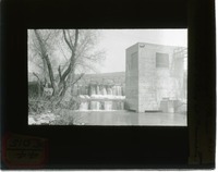
 Wauneta Falls
 Original caption: Wauneta Falls, Republican River, Wauneta, Nebr. Chase County. (121111-00108)
-
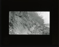
 Limestone, Oreapolis
 Original caption: XXIV-6 NAB. Apr. 14, 1912. Two lower l.s. in scarp west of Oreapolis. Basal ledge is the lowest in Nebraska series. Cass County. (121111-00227)
-
 Limestone, Jone's Point
 Original caption: XXII-1. N.A.B. Dec 2, 1911. First two l.s. below massive Jone's Point. Upper called Fin ? Lower, G, the coral ledge. Intervening shale. 7 Cass County. (121111-00232)
-
 Limestone
 Original caption: XXI-1 NAB. Second l.s. exposed at Jones Pt. reckoning from So. Cass County. (121111-00242)
-
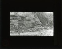
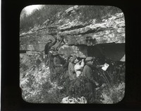 Rock ledge, South Bend
 Original caption: Ledge formerly quarried at Green's exposure in lower part of bluffs opp. So. Bend. NAB. Oct 21, 1911 Group of men viewing and stand beneath ledge. Cass County. (121111-00246)
