
C. Barron McIntosh, Cass County, Nebraska
The C. Barron McIntosh photographs and lantern slides were collected and retained within McIntosh’s records and department files. The lantern slides were most likely used as teaching slides in early geography classrooms at the University of Nebraska. The photographs and lantern slides may include those taken by George Condra (GEC, Condra) , Frank H. Shoemaker (F.H.S., FHS), and others identified by last name or initial in the captions. Other initials on the slides are “L.H.,” and “NAB,” possibly Nels A. Bengston.
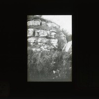
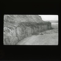
Limestone, Rock Bluff Point
Original caption: “Lower ledge of l.s. at Rock Bluff Point, so. of Plattsmouth, Nebr. Film XVII 6. 10-13-’11 NAB.” Cass County. (121111-00228)
Cullom ledge, Plattsmouth
Original caption: “XXVI-4 NAB. Apr. 18, 1912. Massive ledge in n.w. point of bluff, East of Cedar Creek, Nebr., Part of Plattsmouth l.s.” Cass County. (121111-00230)
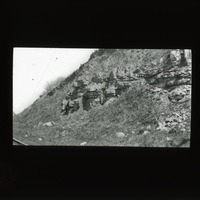
Limestone, Oreapolis
Original caption: “XVIII-1 NAB. Apr. 20, 1912. Massive ledge exposed on North side of Platte R. opp. Cullom. The Plattsmouth l.s. NAB 20.” Case County. (121111-00231)
Limestone, Weeping Water
Original caption: ” NAB. Film XXIV-3 4/3 1912. Shows two upper l.s. in scarp east of Cullom. Upper is 1st above Plattsmouth l.s. Lower is upper part of Plattesmouth l.s.” Cass County. (121111-00233)

Limestone, Weeping Water
Original caption: “XXIV-5 NAB. Apr. 19, 1912. Upper l.s. in scarp west of Oreapolis. Part of Plattsmouth l.s.” 1912. Cass County. (121111-00235)
Limestone, Weeping Water
Original caption: “Ledge of National Stone Quarry, east of Louisville. 1911,” Cass County. (121111-00236)
Limestone, Weeping Water
Original caption: “8-27-6-11. Limestone blocks Weeping Water. No 1.” Cass County. (121111-00237)
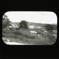
LImestone, Cedar Creek
Original caption: “7-27-?-11. Limestone blocks, Weeping Water. No. 2.” Cass County. (121111-00238)
Limestone, Plattsmouth
Original caption: “6-27-6-11. Limestone blocks, Weeping Water, No. 3.” 1911. Cass County. (121111-00239)
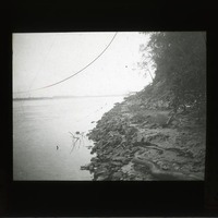
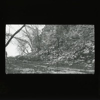
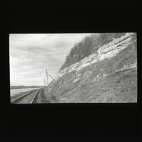
Limestone, Missouri River
Original caption: “First l.s. exposed near Mo. R., level north of Weeping Water valley. Looking South. Film XVII-3. N.A.B. 10-12-11” 1911. Cass County. (121111-00241)
Limestone, Louisville, South Bend
Original caption: “Louisville & South Bend Limestones. Class studying carboniferous strat. Meadow, Nebr.” Cass County. (121111-00245)
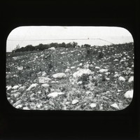
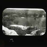
Glacial boulders
Original caption: “Glacial boulders on land so. E. of Table Rock. GEC 1911.” Cass County. (121111-00320)
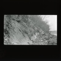
![Original caption: [Drift] Loess Hills, rolling phase, near Plattsmouth, Nebr. 46 L.H. Cass County. (121111-00322)](https://archives-spec.unl.edu/files/square/e2a458f9de2b0db34b6a9fb7672939260cb0034e.jpg)
Loess hills, Plattsmouth
Original caption: “[Drift] Loess Hills, rolling phase, near Plattsmouth, Nebr. 46 L.H.” Cass County. (121111-00322)
![Original caption: 14-9-09 View in [Yankee Hill Clay pit.] Cullom Gravel. Cass County. (121111-00272)](https://archives-spec.unl.edu/files/square/bcf507457f8425baf05203681300b68909389827.jpg)
Yankee Hill clay pit
Original caption: “14-9-09 View in [Yankee Hill Clay pit.] Cullom Gravel.” Cass County. (121111-00272)
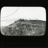
Flint ledge, South Bend
Original caption: “The flint ledge at old quarry opp. So. Bend, Nebr. 1911” Group of men standing at base of flint ledge. Cass County. (121111-00247)
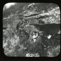
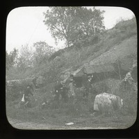
Rock ledge, South Bend
Original caption: “Ledge formerly quarried at Green’s exposure in lower part of bluffs opp. So. Bend. NAB. Oct 21, 1911” Group of men viewing and stand beneath ledge. Cass County. (121111-00246)
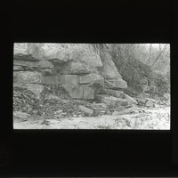
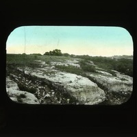
Limestone
Original caption: “XXI-1 NAB. Second l.s. exposed at Jones Pt. reckoning from So.” Cass County. (121111-00242)
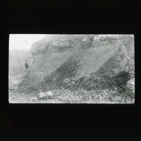
Limestone, Jone's Point
Original caption: “XXII-1. N.A.B. Dec 2, 1911. First two l.s. below massive Jone’s Point. Upper called Fin ? Lower, G, the coral ledge. Intervening shale. 7′ ?” Cass County. (121111-00232)
Limestone, Oreapolis
Original caption: “XXIV-6 NAB. Apr. 14, 1912. Two lower l.s. in scarp west of Oreapolis. Basal ledge is the lowest in Nebraska series.” Cass County. (121111-00227)