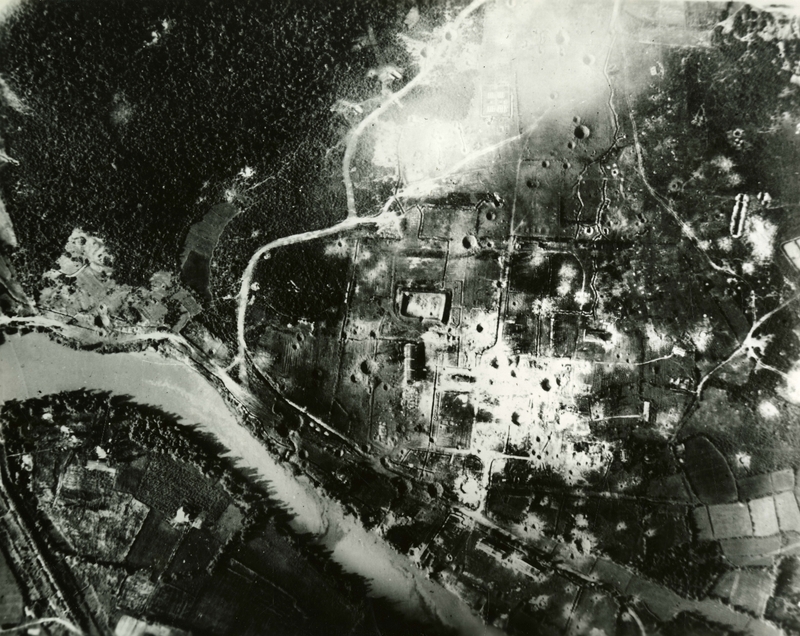
Aerial photo of bombed Vinh Linh barracks area
Item
-
derivative filename/jpeg
-
363-02947.jpg
-
Digital Object Identifier
-
363-02947
-
Title
-
Aerial photo of bombed Vinh Linh barracks area
-
Description
-
Original caption: "Saigon - Bombed Barracks Area - Struck by Air Force F-4C Phantom and Republic of Vietnam Air Force (VNAF) A-1H Skyraider pilots the Vinh Linh barracks area 10 miles north of the demilitarized zone is more than 90 percent destroyed. Throughout the past year, Air force pilots attacked Communist North Vietnam barracks areas about 440 times." Aerial photo of a bombed landscape with a river, roads, a forest, and farm land.
-
Date
-
1966. Feb. 5
-
Subject
-
Vietnam War, 1961-1975; Aerial reconnaissance; Aerial photography; Bombing, Aerial; United States. Air Force; Phantom II (Jet fighter plane); Skyraider (Attack plane); Barracks; Vietnam (Republic). Không quân
-
Location
-
Saigon, South Vietnam
-
Coordinates
-
10.8231; 106.6297
-
Size
-
20 x 25 cm
-
Container
-
B143, F18
-
Format
-
black-and-white prints (photographs)
-
Collection Number
-
MS 363
-
Collection Title
-
Beverly Deepe Keever, Journalism Papers
-
Creator
-
United States. Air Force
-
Collector
-
Keever, Beverly Deepe
-
Copyright Information
-
These images are for educational use only. To inquire about usage or publication, please contact Archives & Special Collections.
-
Publisher
-
Archives & Special Collections


