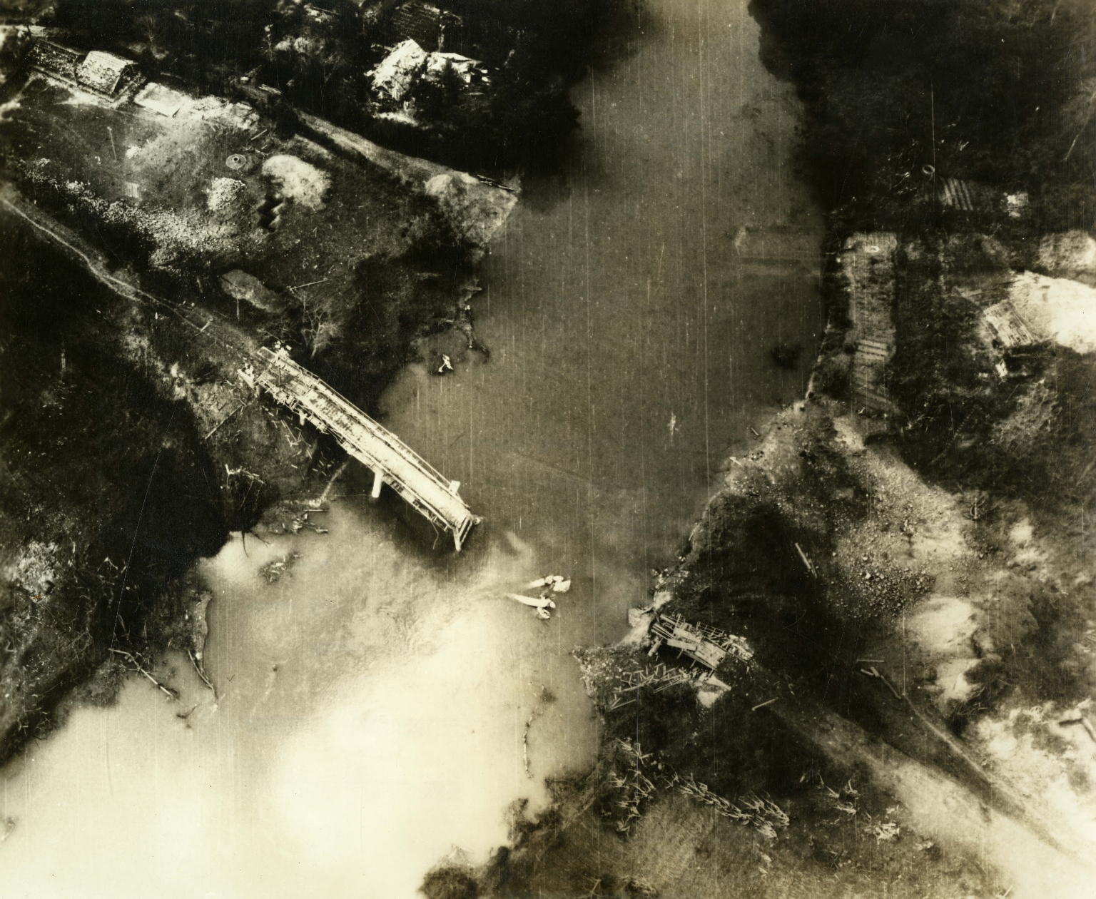
Aerial photo of bombed Lang Met Highway Bridge
Item
-
derivative filename/jpeg
-
363-02943.jpg
-
Digital Object Identifier
-
363-02943
-
Title
-
Aerial photo of bombed Lang Met Highway Bridge
-
Description
-
Original caption: "Saigon - Destroyed Bridge - On their first mission northeast of Hanoi (Oct. 5, 1965) Air Force F-105 Thunderchief pilots destroyed the Lang Met Highway Bridge on Route 1A, 45 miles northeast of the Communist North Vietnam capital. During the past twelve months, Air Force pilots reported destroying over 300 bridges and damaging about 840 other in the Communist North." Aerial photo of a bombed rail bridge.
-
Date
-
1966, Feb. 5
-
Subject
-
Vietnam War, 1961-1975; Aerial reconnaissance; Aerial photography; Bombing, Aerial; United States. Air Force; Bridges; Thunderchief (Jet fighter plane)
-
Location
-
Saigon, South Vietnam
-
Coordinates
-
10.8231; 106.6297
-
Size
-
20 x 25 cm
-
Container
-
B143, F18
-
Format
-
black-and-white prints (photographs)
-
Collection Number
-
MS 363
-
Collection Title
-
Beverly Deepe Keever, Journalism Papers
-
Creator
-
United States. Air Force
-
Collector
-
Keever, Beverly Deepe
-
Copyright Information
-
These images are for educational use only. To inquire about usage or publication, please contact Archives & Special Collections.
-
Publisher
-
Archives & Special Collections