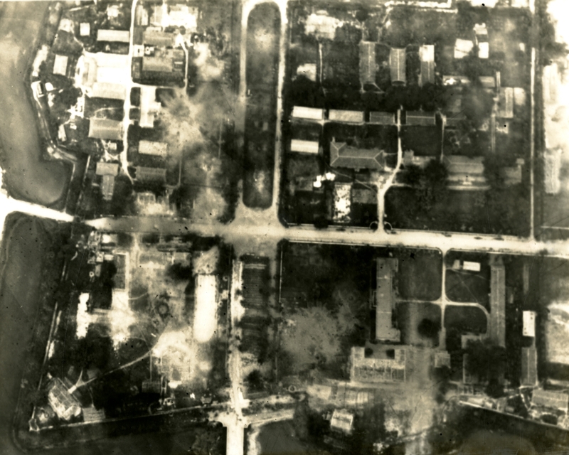
Aerial photo of Dong Hoi army barracks
Item
-
derivative filename/jpeg
-
363-02492.jpg
-
Digital Object Identifier
-
363-02492
-
Title
-
Aerial photo of Dong Hoi army barracks
-
Description
-
Original caption: "Aerial reconnaissance of a section of the Dong Hoi army barracks, located 35 miles north of the demarcation line, shows some of the heavy damage inflicted by a joint USAF and VNAF strike force. Eight VNAF A-1H and four USAF F-104s struck the target with 27 tons of 50 to 500 pound general bombs rockets. Reports showed that 80 percent of the barracks buildings, seen along the bottom and right side of the photo, were destroyed or damaged during the attack." Aerial photo of a street and buildings.
-
Date
-
1965, July 3
-
Subject
-
Vietnam War, 1961-1975; United States. Air Force; Aerial photography; Aerial reconnaissance; Bombing, Aerial; Vietnam (Republic). Không quân; Barracks
-
Location
-
North Vietnam
-
Coordinates
-
21.0278; 105.8342
-
Size
-
20 x 25 cm
-
Container
-
B144, F8
-
Format
-
black-and-white prints (photographs)
-
Collection Number
-
MS 363
-
Collection Title
-
Beverly Deepe Keever, Journalism Papers
-
Creator
-
United States. Air Force
-
Collector
-
Keever, Beverly Deepe
-
Copyright Information
-
These images are for educational use only. To inquire about usage or publication, please contact Archives & Special Collections.
-
Publisher
-
Archives & Special Collections


