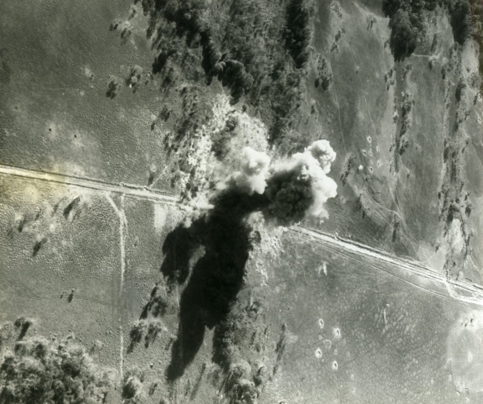
Aerial photo of a bombed highway
Item
-
derivative filename/jpeg
-
363-02399.jpg
-
Digital Object Identifier
-
363-02399
-
Title
-
Aerial photo of a bombed highway
-
Description
-
Original caption: "A direct hit is scored by an Air Force tactical fighter jets on one of the North Vietnam highways leading into South Vietnam. North Vietnam truck convoys have been using the road to transport supplies to the Viet Cong. The aerial reconnaissance photo also shows anti-aircraft gun positions on both sides of the interdicted road." Aerial photo of an air strike on a road.
-
Date
-
1967, Mar. 8
-
Subject
-
Vietnam War, 1961-1975; United States. Air Force; Vietnam (Democratic Republic). Quân đội; Aerial photography; Military convoys; Reconnaissance aircraft; Aerial reconnaissance; Antiaircraft guns
-
Location
-
North Vietnam
-
Coordinates
-
21.0278; 105.8342
-
Size
-
20 x 25 cm
-
Container
-
B146, F6
-
Format
-
black-and-white prints (photographs)
-
Collection Number
-
MS 363
-
Collection Title
-
Beverly Deepe Keever, Journalism Papers
-
Creator
-
United States. Air Force
-
Collector
-
Keever, Beverly Deepe
-
Copyright Information
-
These images are for educational use only. To inquire about usage or publication, please contact Archives & Special Collections.
-
Publisher
-
Archives & Special Collections
-
extracted text
-
�