Aerial photo of truck convoy
Item
-
derivative filename/jpeg
-
363-02391.jpg
-
Digital Object Identifier
-
363-02391
-
Title
-
Aerial photo of truck convoy
-
Description
-
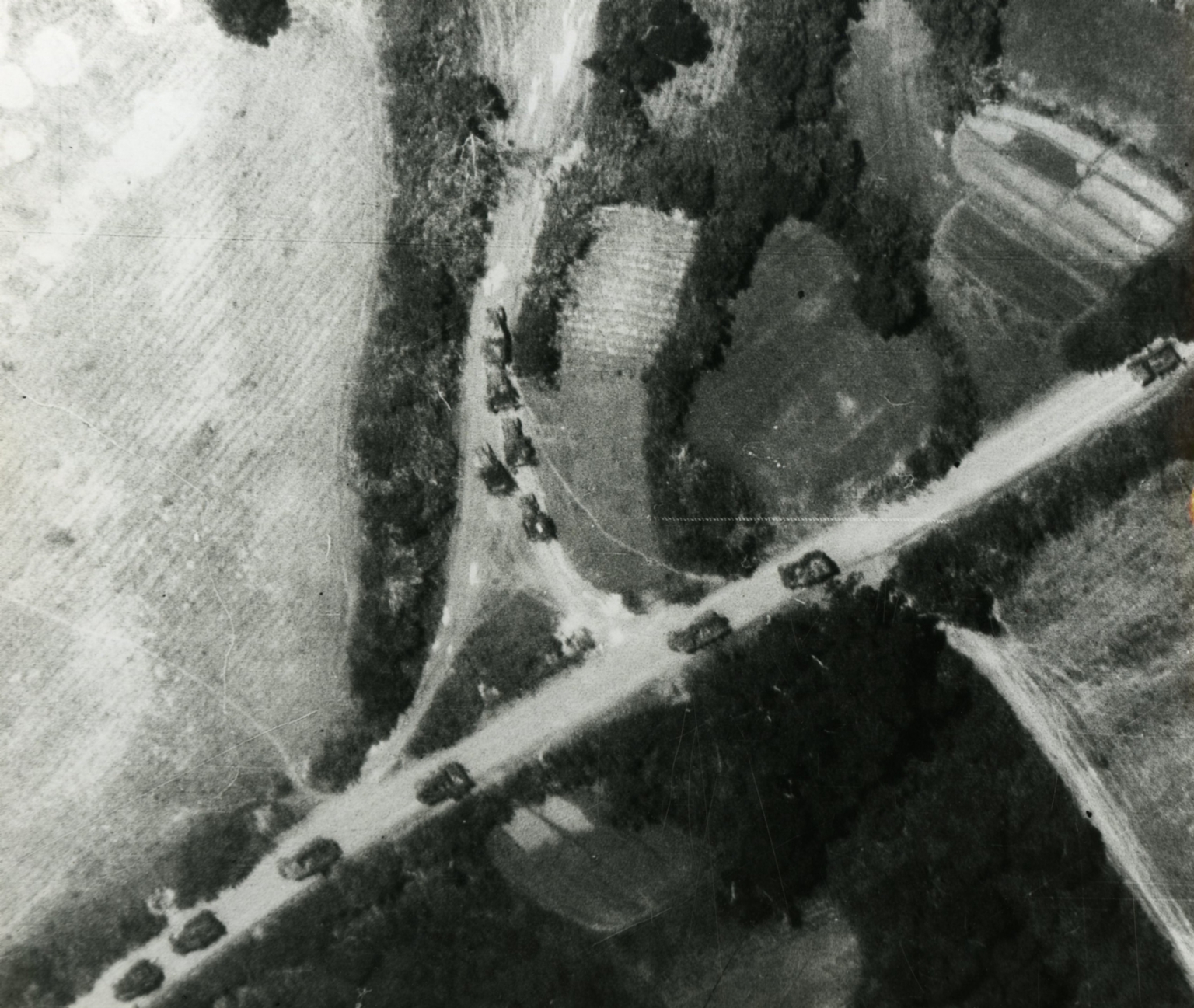
Original caption: "An Air force reconnaissance pilot photographed this truck convoy heading northwest on Route, 106, 50 miles north of the Democration line near Cu Hap, North Vietnam. Of the 12 trucks, five are turning into a truck park located approximately 150 yards east of the highway." Aerial photo of a convoy of vehicles on a rural road.
-
Date
-
1967, Mar.
-
Subject
-
Vietnam War, 1961-1975; United States. Air Force; Vietnam (Democratic Republic). Quân đội; Aerial photography; Military convoys; Reconnaissance aircraft; Aerial reconnaissance
-
Location
-
Cù Hap, North Vietnam
-
Coordinates
-
17.4659; 106.5984
-
Size
-
20 x 25 cm
-
Container
-
B146, F6
-
Format
-
black-and-white prints (photographs)
-
Collection Number
-
MS 363
-
Collection Title
-
Beverly Deepe Keever, Journalism Papers
-
Creator
-
United States. Air Force
-
Collector
-
Keever, Beverly Deepe
-
Copyright Information
-
These images are for educational use only. To inquire about usage or publication, please contact Archives & Special Collections.
-
Publisher
-
Archives & Special Collections
-
extracted text
-
�