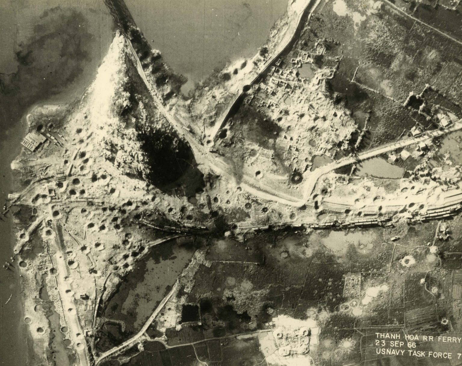
Aerial photo of bombed Thanh Hoa railroad ferry complex
Item
-
derivative filename/jpeg
-
363-02821.jpg
-
Digital Object Identifier
-
363-02821
-
Title
-
Aerial photo of bombed Thanh Hoa railroad ferry complex
-
Description
-
Original caption: "Before and After near Thanh Hoa, North Vietnam - Navy jet pilots of Carrier Air Wing 15 pounded a railroad ferry complex northeast of Thanh Hoa Sep. 21-23, 1966. Targets included a thermal power plant, defending flak sites, railways, boxcars, and roads. After the raid shown in these before and after photos, Navy Intruder and Skyhawk pilots described the area as 'devastated.'" Aerial photo of a bombed landscape with roads, a village, a railway, a river, and farms.
-
Date
-
1966, Sep. 24
-
Subject
-
Vietnam War, 1961-1975; Aerial photography; Landscapes; Aerial reconnaissance; Railroad yards; United States. Navy; Bombing, Aerial
-
Location
-
Thanh Hóa, South Vietnam
-
Coordinates
-
19.8067; 105.7852
-
Size
-
20 x 25 cm
-
Container
-
B144, F7
-
Format
-
black-and-white prints (photographs)
-
Collection Number
-
MS 363
-
Collection Title
-
Beverly Deepe Keever, Journalism Papers
-
Creator
-
United States. Navy
-
Collector
-
Keever, Beverly Deepe
-
Copyright Information
-
These images are for educational use only. To inquire about usage or publication, please contact Archives & Special Collections.
-
Publisher
-
Archives & Special Collections