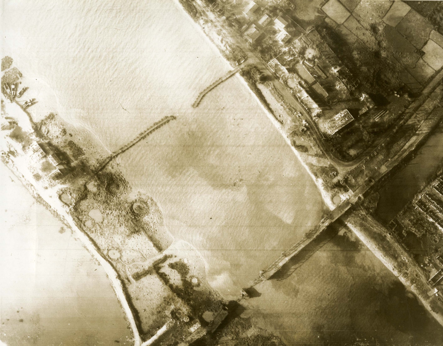
Aerial photo of post-strike Kien An Highway Bridge
Item
-
derivative filename/jpeg
-
363-02657.jpg
-
Digital Object Identifier
-
363-02657
-
Title
-
Aerial photo of post-strike Kien An Highway Bridge
-
Description
-
Original caption: "Pre and post Strike Navy Photography of Kien An Highway Bridge - with the carrier striking force in the Tonkin gulf, Mar. 16 - Shown is the Kien An highway bridge on the southern edge of Haiphong after being severed by 1,000-pound bombs dropped by Navy A4 Skyhawks from the aircraft carrier USS Kitty Hawk. The 658-foot bridge , which links Haiphong with Ninh Binh/Nam Dinh area of North Vietnam, was severed by Navy pilots of Attack Squadrons 144 and 112, led by Cdr. N. Duff Arnold, 40, of San Diego, a Carrier Air Wing 11 pilot." An aerial photograph of a bombed river. There are two cut bridges and craters on the river's shore.
-
Date
-
1968, Mar. 18
-
Subject
-
Vietnam War, 1961-1975; Aerial photography; Landscapes; Aerial reconnaissance; United States. Navy; Bombing, Aerial; Bridges
-
Location
-
Gulf of Tonkin
-
Coordinates
-
19.7500; 107.7500
-
Size
-
20 x 25 cm
-
Container
-
B146, F4
-
Format
-
black-and-white prints (photographs)
-
Collection Number
-
MS 363
-
Collection Title
-
Beverly Deepe Keever, Journalism Papers
-
Creator
-
United States. Navy
-
Collector
-
Keever, Beverly Deepe
-
Copyright Information
-
These images are for educational use only. To inquire about usage or publication, please contact Archives & Special Collections.
-
Publisher
-
Archives & Special Collections