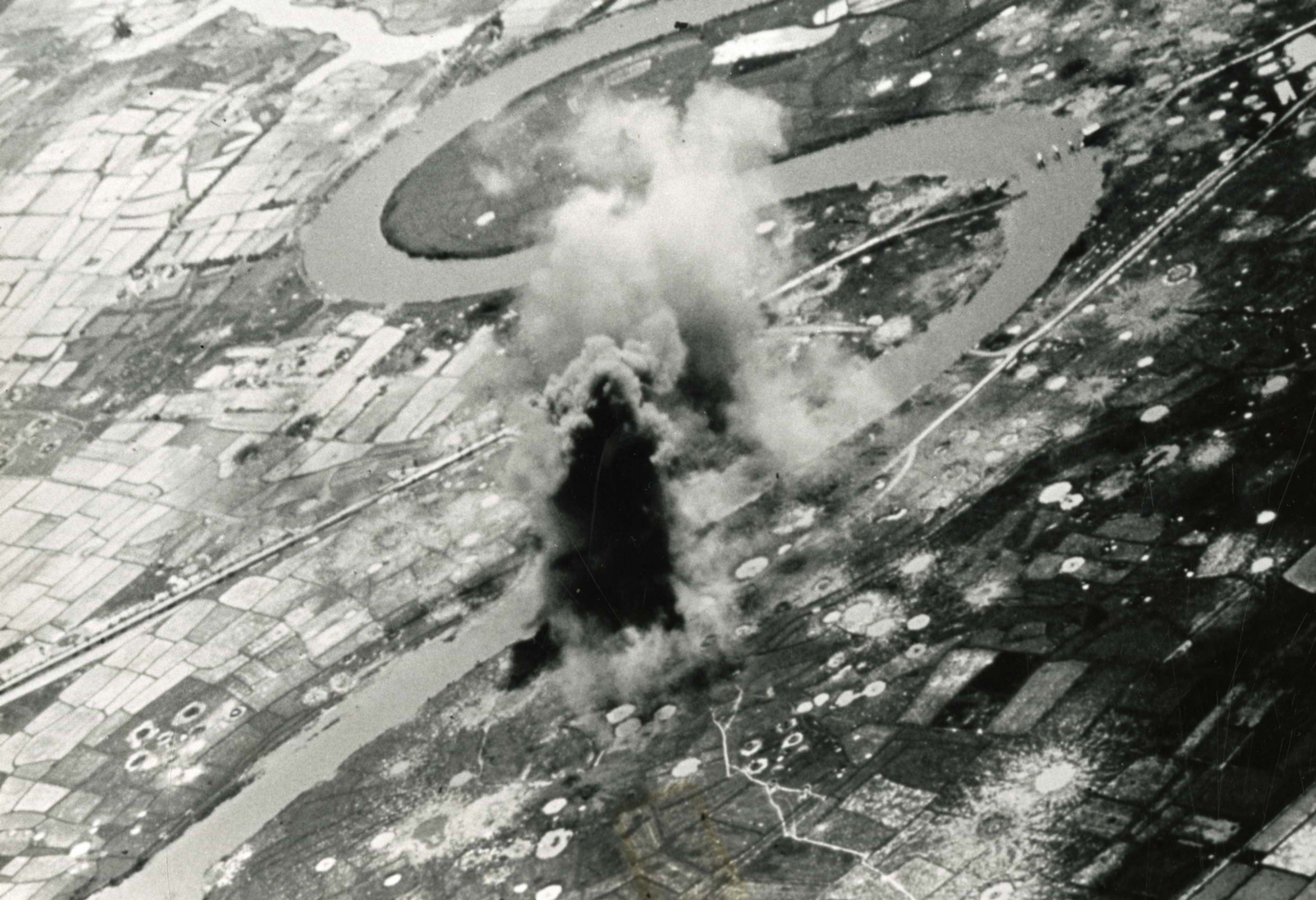
Bombing of the Boi Hoa highway
Item
-
derivative filename/jpeg
-
363-02656.jpg
-
Digital Object Identifier
-
363-02656
-
Title
-
Bombing of the Boi Hoa highway
-
Description
-
Original caption: "Smoke and Dust rise from the Boi Hoa highway ferry, located 37 statute miles southeast of Vinh, during an attack with 500-pound bombs by pilots from the attack carrier USS Hancock, Aug. 27." An Aerial photograph of a bomb going off near a river in a rural area. There are many craters scattered in the landscape.
-
Date
-
1967, approximate
-
Subject
-
Vietnam War, 1961-1975; Aerial photography; Landscapes; Aerial reconnaissance; United States. Navy; Bombing, Aerial; Roads; Hancock (Aircraft carrier : 1944-1976)
-
Location
-
Vinh, North Vietnam
-
Coordinates
-
18.6796; 105.6813
-
Size
-
20 x 25 cm
-
Container
-
B146, F4
-
Format
-
black-and-white prints (photographs)
-
Collection Number
-
MS 363
-
Collection Title
-
Beverly Deepe Keever, Journalism Papers
-
Creator
-
United States. Navy
-
Collector
-
Keever, Beverly Deepe
-
Copyright Information
-
These images are for educational use only. To inquire about usage or publication, please contact Archives & Special Collections.
-
Publisher
-
Archives & Special Collections