Aerial photo of Hai Duong Bridge
Item
-
Title
-
Aerial photo of Hai Duong Bridge
-
Description
-
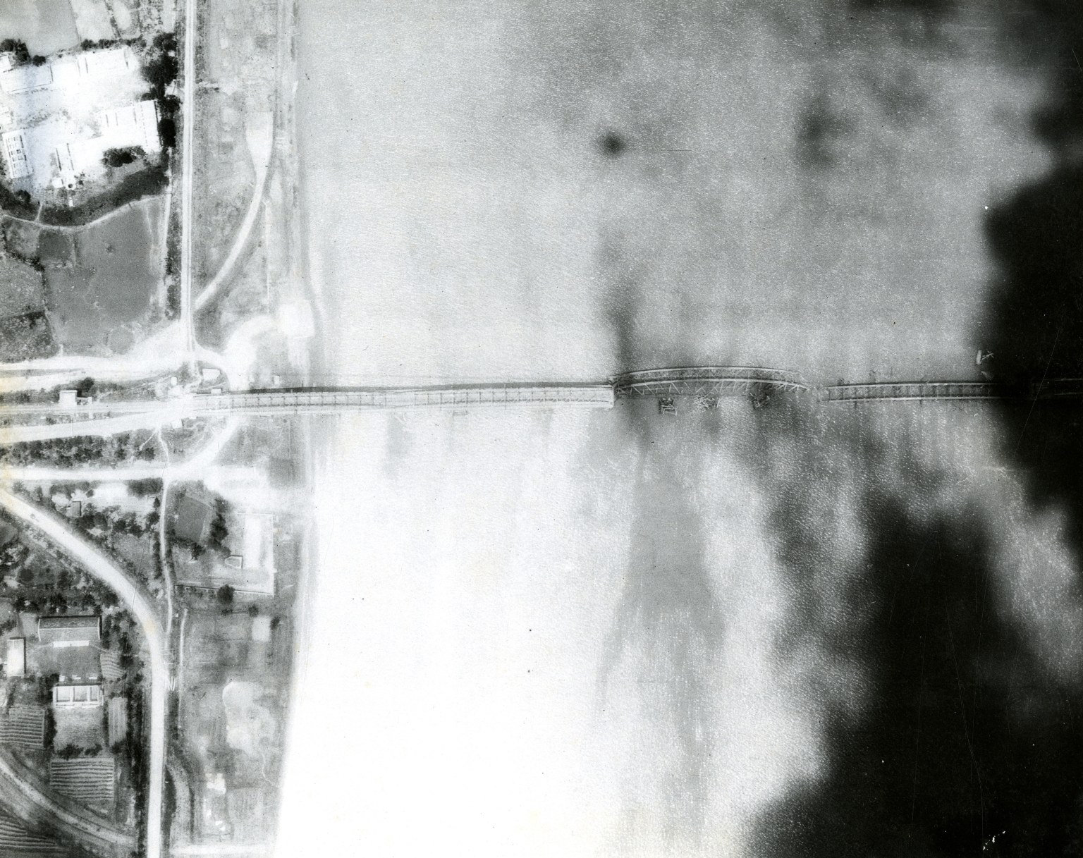
Original caption: "Aerial vertical view of Hai Duong Bridge that was destroyed by USS Kitty Hawk, Airwing embarked operating in the south China sea during Westpac deployment. Aircraft from the attack aircraft carrier USS Kitty Hawk cut the Hai Duong rail and highway bridge, clearly dropping two spans into the water, on Apr. 17. This bridge has long been considered a major transportation artery in North Vietnam and was a much sought-after target. Weather has hampered attacks in the past; however, improved weather conditions allowed A6 bombers and F4 fighter/bombers to launch a surprise attack Sunday." Aerial photo of a bombed bridge.
-
Is Format Of
-
363-02413.jpg
-
Identifier
-
363-02413
-
Date
-
1966, Apr. 21
-
Subject
-
Vietnam War, 1961-1975; United States. Navy; Bombing, Aerial; Jet fighter planes; Vietnam (Democratic Republic). Quân đội; Precision bombing; Aerial photography; Reconnaissance aircraft; Aerial reconnaissance
-
Location
-
Hải Dương, North Vietnam
-
Coordinates
-
20.9373; 106.3146
-
Physical Dimensions
-
20 x 25 cm
-
Is Part Of
-
B147, F1
-
Format
-
black-and-white prints (photographs)
-
Is Required By
-
MS 363
-
Collection
-
Beverly Deepe Keever, Journalism Papers
-
Creator
-
United States. Navy. Fleet, 7th
-
Contributor
-
Keever, Beverly Deepe
-
Rights
-
These images are for educational use only. To inquire about usage or publication, please contact Archives & Special Collections.
-
Publisher
-
Archives & Special Collections