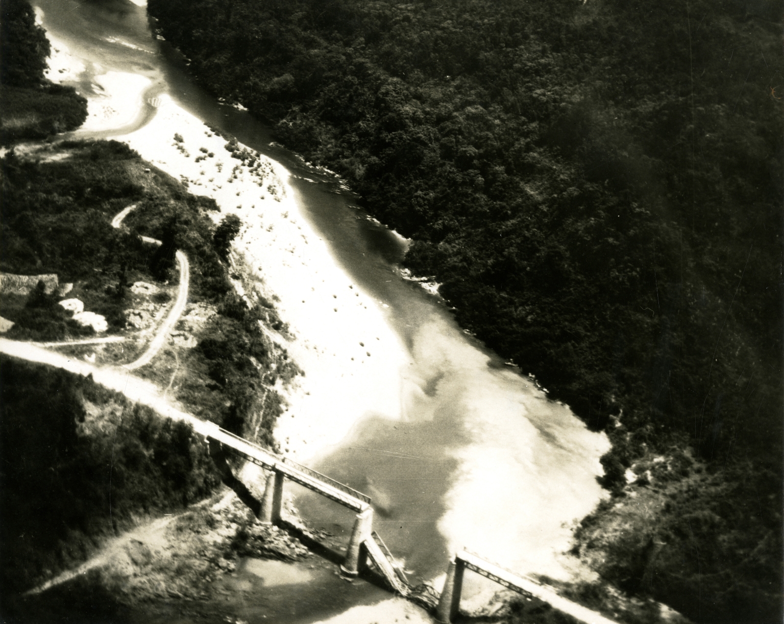
Aerial photo of bombed Xom Ca Trang bridge
Item
-
Title
-
Aerial photo of bombed Xom Ca Trang bridge
-
Description
-
Original caption: "Xom Ca Trang bridge on route 12, 40 miles south of Vinh, at 12:30 today. The 2nd aircraft of the strike group scored a direct hit, dropping 1 span of the 2 span structure." Aerial photo of a bombed bridge over a river
-
Is Format Of
-
363-02404.jpg
-
Identifier
-
363-02404
-
Date
-
1965, Apr. 16
-
Subject
-
Vietnam War, 1961-1975; United States. Navy; Bombing, Aerial; Jet fighter planes; Vietnam (Democratic Republic). Quân đội; Precision bombing; Aerial photography; Bridges
-
Location
-
Vinh, North Vietnam
-
Coordinates
-
18.6796; 105.6813
-
Physical Dimensions
-
20 x 25 cm
-
Is Part Of
-
B147, F1
-
Format
-
black-and-white prints (photographs)
-
Is Required By
-
MS 363
-
Collection
-
Beverly Deepe Keever, Journalism Papers
-
Creator
-
United States. Navy. Fleet, 7th
-
Contributor
-
Keever, Beverly Deepe
-
Rights
-
These images are for educational use only. To inquire about usage or publication, please contact Archives & Special Collections.
-
Publisher
-
Archives & Special Collections