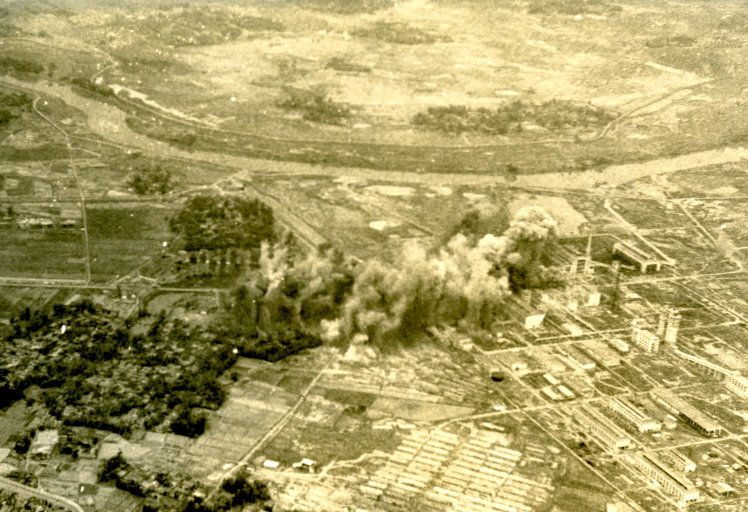
Aerial photo of B?c Giang
Item
-
Title
-
Aerial photo of B?c Giang
-
Description
-
Original caption: "Air strike on B?c Giang thermonuclear power plant. Photo taken March 11 during a coordinated strike from three aircraft carriers. The plant, located 23 miles from Hanoi, was hit from A6 Intruders from Kitty Hawk and other Navy carrier based planes." Aerial photograph of a bombing in a rural area.
-
Is Format Of
-
363-02378.jpg
-
Identifier
-
363-02378
-
Date
-
1967, Mar. 21
-
Subject
-
Vietnam War, 1961-1975; Aerial photography; United States. Navy; Bombing, Aerial; Jet fighter planes; Vietnam (Democratic Republic); Precision bombing
-
Location
-
Bắc Giang, North Vietnam
-
Coordinates
-
21.2820; 106.1975
-
Physical Dimensions
-
20 x 25 cm
-
Is Part Of
-
B146, F6
-
Format
-
black-and-white prints (photographs)
-
Is Required By
-
MS 363
-
Collection
-
Beverly Deepe Keever, Journalism Papers
-
Creator
-
United States. Navy
-
Contributor
-
Keever, Beverly Deepe
-
Rights
-
These images are for educational use only. To inquire about usage or publication, please contact Archives & Special Collections.
-
Publisher
-
Archives & Special Collections